 64th 4000 m summit
11 May 2025 · Bernina
Amandine's adventures in the Engadine
on skisThe track
Distance and elevation gain from the Strava tracks; profile drawn from the GPS. Hover over the map or the profile to locate a point along the track.
The figures
From 10 May (start 11:17) to 11 May 2025 (finish 16:24) · 1 night — Rifugio Marco e Rosa
Summits & route
The summit
Day by day
- D1Morteratsch > Rifugio Marco e Rosa
- D2Spallagrat > Piz Bernina > Morteratsch
Climbing partner
Click a name to see their map.
Topos & references


The story
Piz Bernina, the easternmost 4000er in the Alps. It is also the highest point of the Rhaetian Alps, or Graubünden Alps, and to meet it we have to go to the heart of the canton of Graubünden, in the Upper Engadine. A very remote summit, fairly wild in spring but not particularly difficult, whose ascent looks like an interesting goal as a first 4000er for Amandine.
Day 1 — Landing in the Engadine
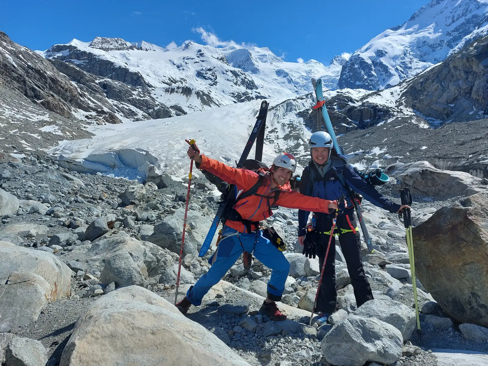
After a 6 h 30 journey on 7 trains — a true railway odyssey across Switzerland — we finally reach Morteratsch, at the foot of the glacier of the same name. The logistics have been carefully prepared in advance, and as soon as the train doors open we charge off towards our objective, visible on a bearing of 198.5°, 8.01 km away and 2151 m above our heads.
Conditions are fairly favourable. After an approach path swallowed at a run, we pick up a track going up the glacier and deduce that 4 skiers passed this way that same morning. They probably set off between 3 and 6 a.m., whereas it's 12:30 when we start up it.
Thick clouds have the merit of partly shielding us from a crushing sun, but prevent me from analysing in the distance everything that might interest me: snowpack, crevasses, slides, cornices…
We can make out a few gaping crevasses beneath our skis; fortunately the temperatures of the previous days leave me confident about the strength of the snow bridges as we pass.
In the afternoon, we see 2 parties of 2 skiers coming back down. That confirms the morning's observation. At around 3300 m, the track splits: two skiers seem to have headed for Piz Zupò. At around 3500 m, the two remaining skiers went straight for Piz Bernina, without stopping at the Marco e Rosa hut, where we are heading. The fog that has settled in and the very poor visibility prevent me from seeing where they went next or our own route, and we cover the last metres to the bivouac navigating by GPS.
To our surprise — and even more to theirs! — we find two Czechs there. They came up from the Italian side and are on a multi-day tour of the massif. For them, plenty of fatigue already built up, and no Piz Bernina on the next day's programme.
Day 2 — Slab trouble
Waking up at 3597 m in our little bivouac perched on its rocky spur, with an absolutely superb panorama over Lombardy. The sky is clear, letting us gaze at all the summits hidden the day before.
7:30, skis on, we start the climb towards the summit ridge. The day before I had reckoned that a few rope teams setting out from the Diavolezza hut might well join the party today. But I didn't expect to see half a dozen of them, more or less close to us!
We leave the skis and are the first onto the ridge. The rocky sections are fun, offering nice, fairly vertical climbing on good holds (a few grade III/IV passages). I'm bothered, though, by the veils of cloud that stop us seeing into the distance and getting a view of the summit. After an hour on mixed ground, we reach a snow section. As we skirt a fracture line almost a metre thick on our left, the mist lifts for a few moments and lets me see the extent of the damage: a huge slab (30–40 m wide and 60–100 cm thick), released less than a metre below the ridge, has swept the East flank for 70–100 m below.
The rest of the ridge is completely free of tracks… The slopes are steep and loaded to the hilt, swollen and steepened by serious snowfall. Not a single rock showing on the ridge: everything is loaded to the max.
I instantly understand what happened, and the realisation is bitter: yesterday's two climbers triggered the slab on their way up. They must have had one hell of a fright, with the whole ground giving way beneath their crampons, but they were skilful enough not to be carried away with it. After such a shock, it's pretty obvious why they chose to turn back.
Drat, drat, drat. I realise that reaching the summit in these conditions is likely to be very complicated.
We are at 3995 m, some fifty metres before La Spedla (4018 m), the fore-summit of Piz Bernina, which itself is another 250 m further along the ridge. What options do we have? Stay as close as possible to the crest of the ridge, so as to trigger any slab below us while managing to “hang on” to the crest? Or go back down yesterday's avalanche path and then bypass La Spedla via the rocks and slopes, probably less slabby? Both options involve far more exposure than planned, and in both cases keeping the rope on would be unthinkable, as it would be much more dangerous. And Amandine climbing unbelayed is not an option.
Blast, this wasn't planned at all. Neither the slabs nor the poor visibility.
I feel ready to test the ground and lead the way, but I can't leave Amandine alone in case something goes wrong. And the lack of visibility, already a problem for the ascent, becomes downright critical if things turn bad. So we wait… For the visibility to improve, for the climbers behind to arrive and give their view. The wait is long but conditions are gentle: no wind, a bit of sun… but still those wretched clouds hiding what lies ahead! After a good half hour, two rope teams finally arrive. I explain the situation to them, and after a few minutes of discussion among themselves their decision is clear: no summit in these conditions.
The same view from the skier who came up alone, and from the two rope teams that follow. It's understandable, and I don't insist in the slightest. You can't commit strangers to situations they haven't chosen. I have to take Amandine's view into account, think rationally, set aside all the emotional aspects, and make a well-judged choice.
The conclusion of my reflection: attempting it alone and with good visibility is acceptable in my eyes.
A little more waiting and the window comes: the veil seems to be lifting for a good while. Amandine is at peace with my decision, and I set off calmly while behind us, rope teams coming up cross paths with rope teams going down.
The first option, staying as close as possible to the crest, turns out not to be the right one. After ten minutes or so of very cautious progress, I find the exposure too great and stop 2 metres (!) below La Spedla. The rest of the ridge looks acceptable, but these few metres separating me from the fore-summit are a deal-breaker: too steep, too loaded.
I look at the slopes below, I scrutinise the snowpack, and the second option now seems sensible: the late-morning hour and the sun have worked the snow and guarantee an optimal consistency in the steep parts, while the few rocks poking through will greatly reduce the slab risk.
Twenty minutes later, I stand on the summit of Piz Bernina. I'm focused but relaxed, at peace with myself. I had a technical margin and didn't launch into anything reckless, keeping the exposure acceptable in my eyes. From here, I can see the whole ridge, the climbers who turned back, and those watching me from the spot where I decided to carry on. A group of 3 followed my tracks to the fore-summit, but won't cross the few deal-breaking metres separating them from La Spedla either.
The clouds have partly returned. I descend carefully down a snow slope transformed on the surface, two ice axes in hand, kicking my crampons deep into the hard snow.
I rejoin Amandine and thank her for her patience. I'm somewhat disappointed not to have been able to take her to the summit, but I reassure myself that today, sadly, it just wasn't possible: these difficult conditions didn't allow me to guarantee her safety. And the fact is that out of the fifteen or so climbers on the route that day, nobody else reached the summit… Fortunately, she's delighted to be able to climb a few more metres to reach the fateful altitude of 4000 metres! All the other climbers have gone down: we were the first to arrive, and we'll be the last to leave.
The clouds have taken their bow and now let us make the descent in full visibility and serenity: after a few abseils and some careful downclimbing, a superb descent of several kilometres in beautiful snow, through a spectacular glacier, brings us gently back to the peaceful, bucolic lower slopes of the mountain.
Day 3 — Unwinding in the flowery meadows
Having crossed a whole country and entire massifs, we might as well stay in the area and enjoy discovering it! A warm thank-you to Mr Bernhard for kindly lending us the keys to their little chalet perched high in the Graubünden mountains.
This day is placed under the “Discover Graubünden PDO” label, with strolls through flowery meadows, walks in the forest, provisions enjoyed in the shade of the fir trees… and plenty of wonder at landscapes that sum up all the beauty and harmony of that marvellous little corner of the Earth that is Switzerland.